Academy Sports + Outdoors
Academy, LTD
skip to main contentMain content starts here.
 Academy Credit Card
Kids' Sport Accessories
Socks + Accessories
Knives + Self Defense
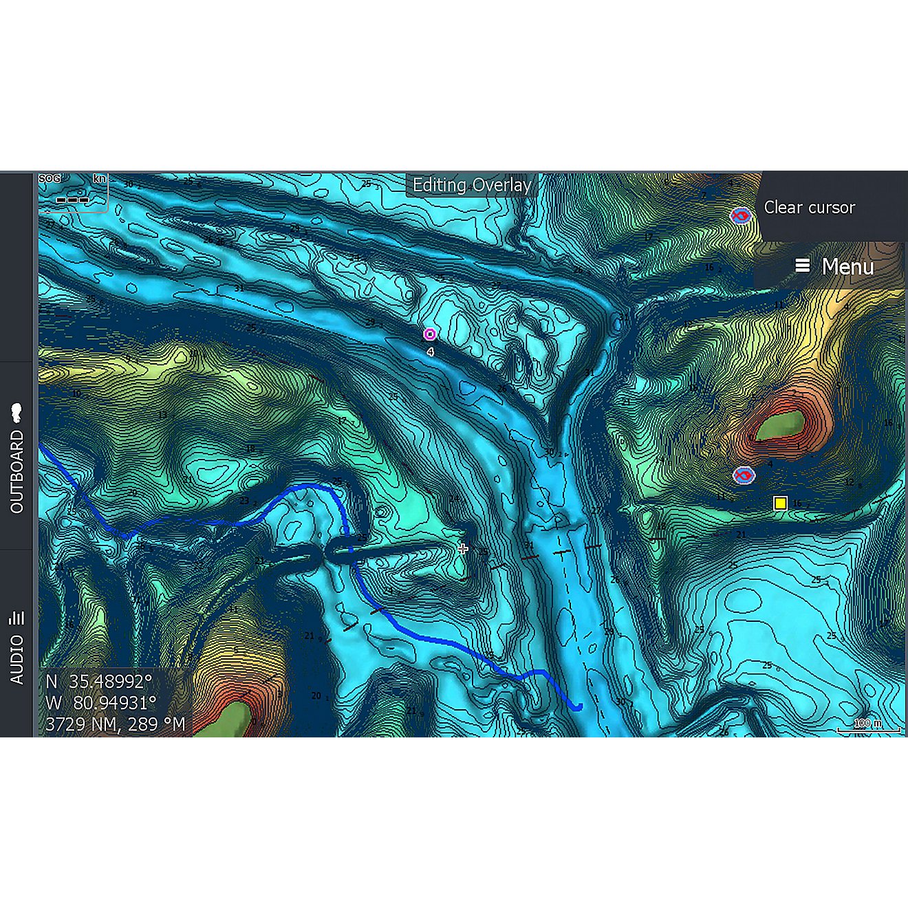
C-Map Reveal South Eastern US Lakes
Double tap to zoom


C-Map Reveal South Eastern US Lakes
$179.00
$170.05$170.05 with Academy Credit Card
Your price after 5% discount when using your Academy Credit Card. Apply Now
Quantity
STYLE IT WITH
about this product
SKU: 131487728
ITEM: M-NA-Y214-MS
Navigate your way through Inland shores with ease when you use the C-Map Reveal South Eastern US Lakes. This map is compatible with Lowrance, Simrad and B&G Chartplotters and contains inland maps of Alabama, Georgia, Tennessee, Kentucky, Virginia, North Carolina, South Carolina and Florida lakes. The full featured vector charts include tides, currents and detailed Marina Port Plans. The Shaded Relief offers custom depth shading for enhanced views of river and lake beds, while the Custom and Easy Routing utilizes chart data and your personalized vessel information to create safe routes Micro SD card format.
Features and Benefits
- Contains inland maps of Alabama, Georgia, Tennessee, Kentucky, Virginia, North Carolina, South Carolina and Florida
- Delivers up to 3,000 waypoints, 100 routes, 100 trails with up to 10,000 points per trail
- Full featured vector charts include tides, currents and detailed Marina Port Plans
- Hi-Res bathymetry and integrated Genesis Layers
- Shaded Relief offers custom depth shading for enhanced views of river and lake beds
- Custom and Easy Routing utilizes chart data and your personalized vessel information to create safe routes
- Comes with subscription free routing and 12-month free updates
- Micro SD card format
- Compatible with Lowrance, Simrad and B&G Chartplotters
Specifications
- CD title memory: No
- HD ready: No
- Product Type: Marine Electronics
- Professional installation required: No
- CD text: No
- Activity: Boating
- Style: Mapping Software
What's in the Box
- C-Map Reveal South Eastern US Lakes
Your Feedback Matters!